Words & Photos: Clay Dolan
THE BEAVER RIVER’S headwaters originate in farm fields near the town of Ceylon before making their way to Eugenia, where the river is dammed creating Eugenia Lake. Once the river spills over Eugenia Falls, it collects water from the entire Beaver Valley Watershed. It isn’t until just north of the town of Kimberly where the river becomes navigable by canoe, and this is where the first river access point is located. It is roughly 15 kilometres from the first access point near Kimberly to the pull out in Heathcote, which will take paddlers four to five hours to complete. For a shorter excursion, paddlers can put in at Access point 2, which is located near Epping where Side Road 19 crosses the river. From here it is a five-kilometre paddle to Heathcote, and can be done in under two hours.
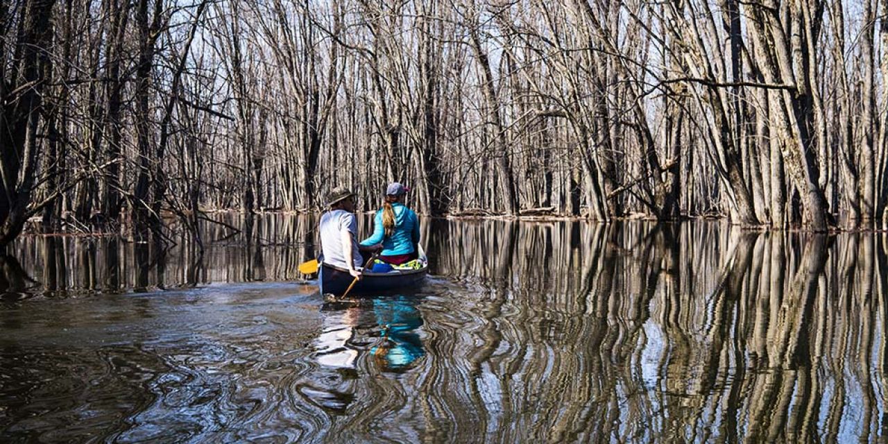
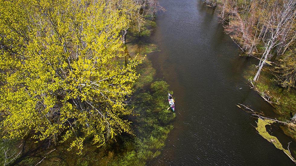
During the spring months the Beaver River can spill over its banks, filling low-lying areas along its route, offering a chance to paddle through flooded forest. When water levels are exceptionally high, paddlers will have to get low in their vessels to pass under a couple of the steel-framed bridges. The current can be swift in a few locations, but generally the river flows gently making it an easy paddle for all ability levels. With its easy access, relatively short routes and tranquil paddling conditions, the Beaver River is perfect for family adventures.
THE SAUGEEN RIVER is the third largest river system in Southern Ontario. It begins in the Osprey Wetland Conservation Lands just south of Maxwell. From there the Saugeen flows roughly 190 kilometres north-west to Southampton where it meets Lake Huron. Although there are two access points further upstream, the main paddling route begins at the town of Hanover and travels 102 kilometres to the end point at Denny’s Dam, five kilometres north of Southampton.
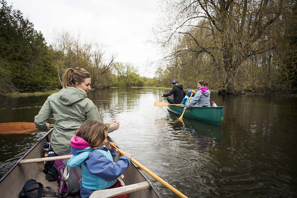
The Saugeen River is one of the most popular paddling routes and for good reason. With many camping locations along its course, the river can be paddled in its entirety in three or four days (21 to 27 hours). Or if a multi-day canoe trip doesn’t work for your schedule, there are 15 access points, each offering a variety of lengths and landscapes to enjoy.
The town of Paisley, located roughly at the midway point, has become the unofficial paddling centre for the Saugeen River. Access points 9A and 9B have docks that make loading and unloading easier. 9B is located closest to the historic downtown, where you can find several great restaurants, eclectic shops and an LCBO. Paddlers doing the multi day excursion, often stop in Paisley to stock up on groceries, dry out wet clothing in the laundromat and even enjoy a meal on the patio at Bonfire on Queen.
River conditions along the Saugeen vary from wide, calm sections to stretches with small rapids and eddies suitable for all skill levels. In the spring however, some rapids can be a little more challenging when water is high and fast flowing. Conversely the higher water levels make some of the shallower sections easier to navigate.
For more information please visit Saugeen Conservation’s website at saugeenconservation.com
Explore the Bruce has a fantastic breakdown of the tours available on the Saugeen with each section of the river outlined in detail. Visit explorethebruce.com/routes/paddling-tours/3/
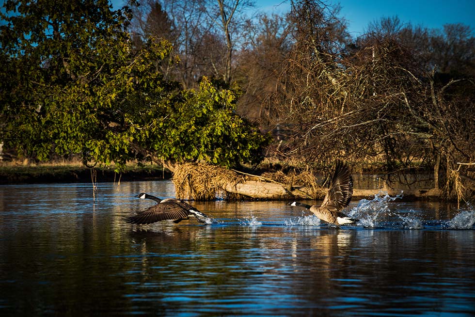
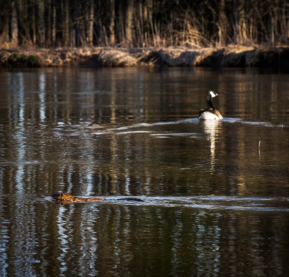
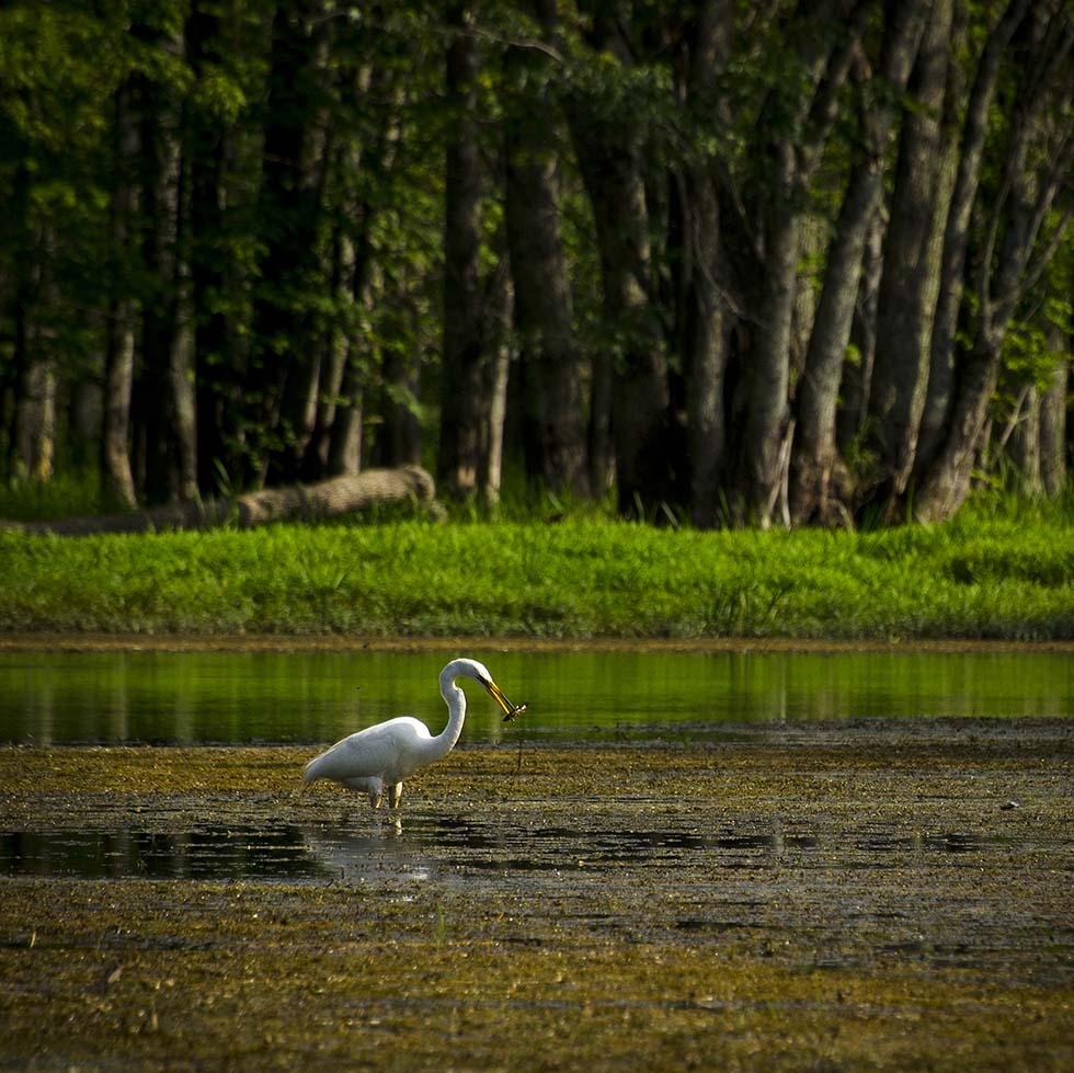
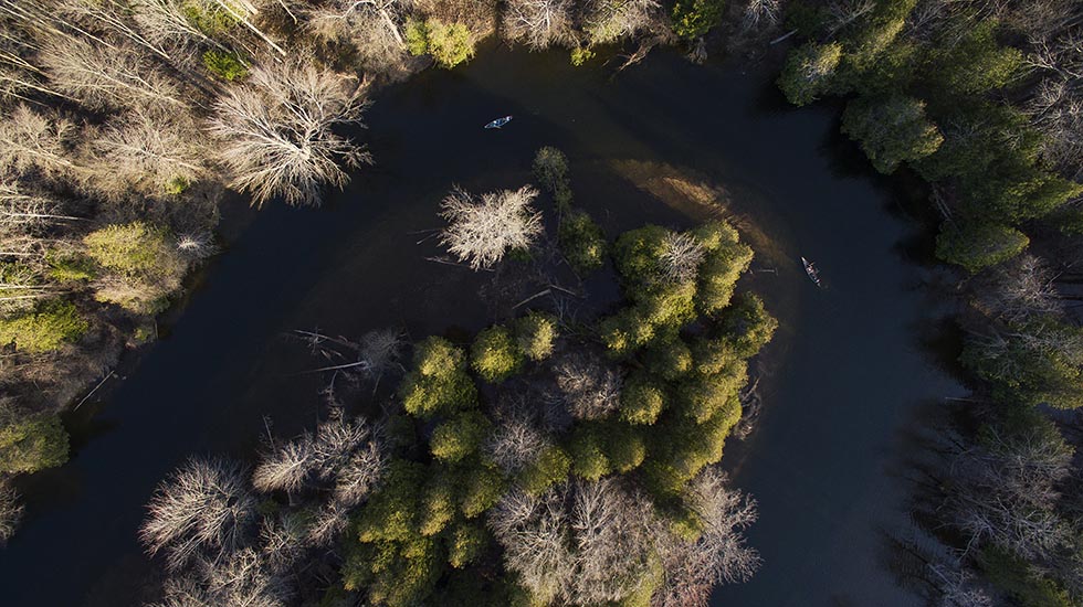
The high-water levels during the Spring months provide a unique opportunity to experience the Escarpment’s main watercourses. Swifts and rapids normally docile throughout the summer provide added excitement in the spring when water is fast flowing. Flooded lands offer paddlers a chance to go beyond the river channels and explore submerged forests and grasslands, while at the same time allowing closer wildlife viewing. The landscape seems to change daily as the trees begin to bud, and the rivers come alive with colour. Even the soundtrack changes as migrating birds return to their summer wetland habitat. With a number of well-maintained access points, all within a short drive, paddlers have the option of going for a quick two-hour jaunt or a multi-day adventure.
SAFETY FIRST.
High, cold water can be expected and is dangerous for inexperienced paddlers. It may look like fun, but the high volumes of water can overpower your canoe leaving you at the mercy of the river. AVOID SWEEPERS. Fallen trees, branches or logs in the water. WEAR SECURE FOOTWEAR. When water is low you may need to get out and pull your boat. Getting in and out at the shore can be challenging with clay and rocks. PADDLE WITH A GROUP. If you get into trouble, you can help each other out. BRING A CHANGE OF DRY CLOTHES. If you dump in cold water you will want to get out, get dried off and warmed up to avoid hypothermia. PACK YOUR PHONE IN A WATERPROOF BAG. BRING DRINKING WATER. You can get dehydrated. DO YOUR RESEARCH. Arrange where to put in and pull out. Plan the length of the route and expected time it will take given your experience. TAKE A SPARE PADDLE.
CARRY A BOAT SAFETY KIT INCLUDING:
• a bailer to remove water from your boat
(and a large sponge is a good idea)
• watertight flashlight with batteries
• whistle (or sound signaling device)
• floating rope (15 meters)
In addition, we highly recommend that you carry the following items: first aid kit, sunscreen, hats, sunglasses, snacks, waterproof matches and a knife.
WEAR A LIFEJACKET.


