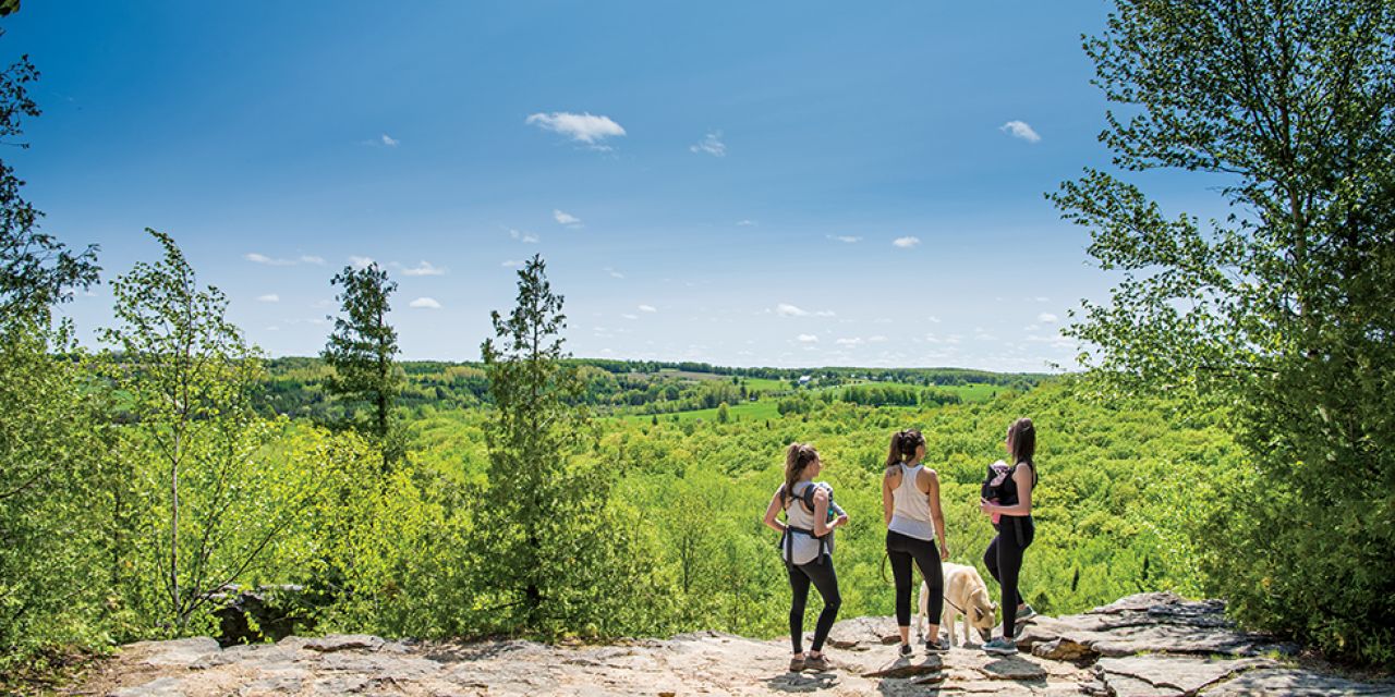
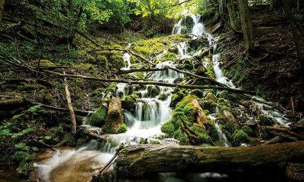
The Nottawasaga Bluffs Conservation Area is a 400-acre jewel on the Escarpment. The unique geology has created a veritable land before time, as deep crevasses cut their way through the hardwood and coniferous forest. Open fields, towering limestone bluffs, and woodlands carpeted in green undergrowth provide the backdrop for one of our area’s hidden gems.
The Bruce Trail, along with the Nottawasaga Valley Conservation Authority (NVCA) trails, create a network throughout the Nottawasaga Bluffs conservation area. One could easily spend an entire day exploring the rugged landscape. For this hike however, we chose to stick to the Bruce Trail and highlight just over seven kilometres. At an average walking speed of 20 minutes per kilometre, this hike will take you around two and a half hours to complete. Add a little more time if you plan to stop and take photos.
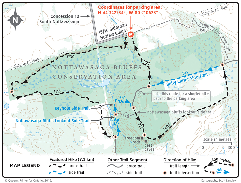

We begin the hike at the NVCA’s parking area on Sideroad 15/16 Nottawasaga. From Collingwood take Highway 124 South toward Singhampton. Just before Singhampton turn left on Mill Town Rd. Then a quick left on Ewing Road. Turn left again on 17/18 Sideroad. Follow as the road bends to the right, then take your first left on Sideroad 15/16. Look for the parking area 500 meters ahead on your right. From Highway 124 there are NVCA signs pointing in you the right direction. (GPS coordinates N 44.342784, W 80.210628).
Since the NVCA has its own trails in the area, it is important to keep a lookout for the white and blue blaze markers of the Bruce Trail. From the parking area head west and follow the main tract of the Bruce Trail marked with white blaze as it winds its way through the forest. The trail then turns south and back east before eventually connecting with the blue blaze of the Nottawasaga Bluffs Lookout Side Trail.
The Blue Mountains Bruce Trail Club recently restored a bridge along the Nottawasaga Bluffs Lookout Side Trail. One of the many examples of the hard work of volunteers who donate their time and energy to this iconic piece of Ontario’s heritage.
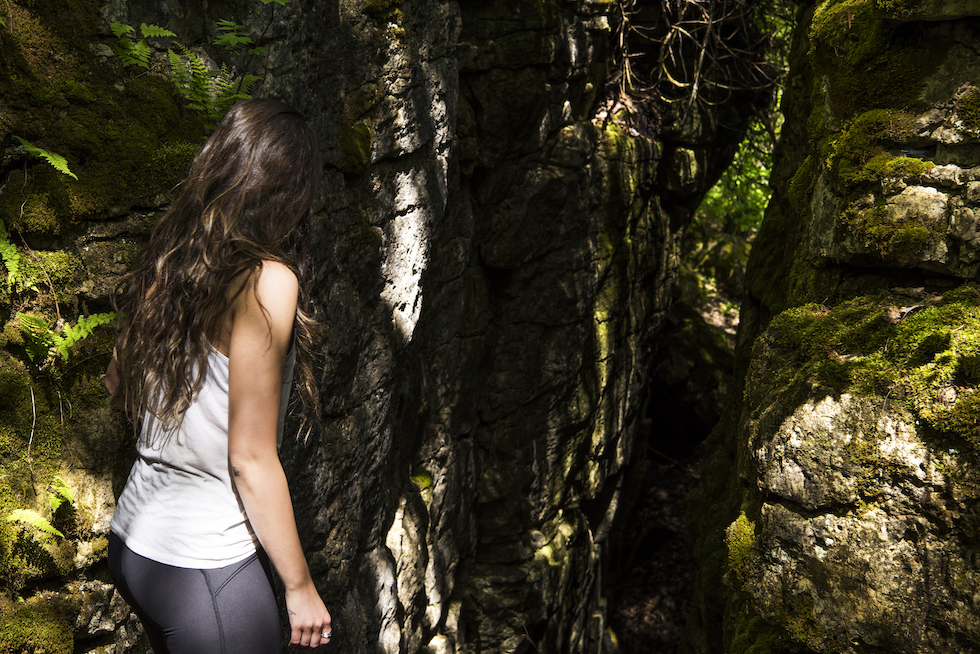
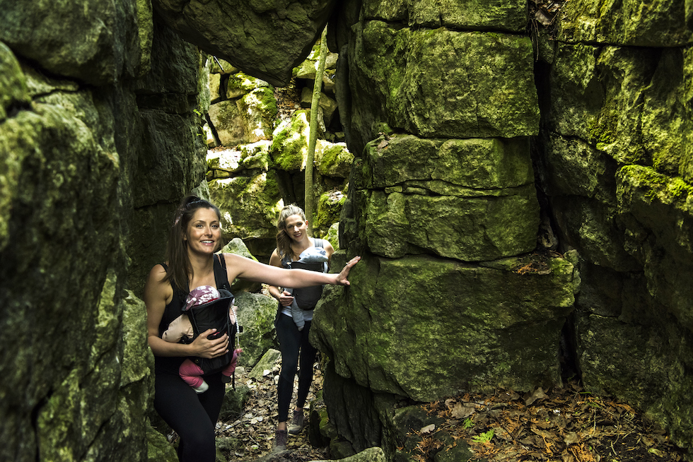
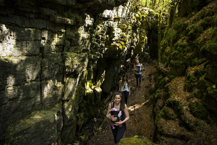
It is a short hike north on the Lookout Side Trail until you reach the Keyhole Side Trail (again marked with blue blaze). This is where things get really interesting as the trail takes you through unique geological features. There are steep climbs and descents through the rugged landscape, where ancient cedars find tiny rays of sunlight in the cold and otherwise dark crevices. Keep a lookout for the blue blaze, as the trail takes a few unexpected turns. Including a tight passageway through the limestone wall, which is the namesake for the side trail.
As you climb out of the dark depths of the limestone crevices you will reach the main tract of the Bruce Trail. Follow it right to head south to Freedom Rock. Here you will be treated to a wonderful view from the edge of the cliff and this is a perfect place for a quick break and refuelling.
As you continue along the trail you will come to a series of deep fissures and crevasses in the forest floor known as Best Caves. Use caution if you choose to explore the subterranean landscape. It was in this area in 2015 that a Collingwood local fell 12 metres while exploring the caves. Seth Rowe spent 22 hours trapped in a space only eight inches wide and in total darkness. Emergency crews from Barrie, Toronto and the local Clearview Fire Department were able to rescue Seth after chipping away at the rock walls to create more space to pull him free.
Back above ground, follow the main trail east until you reach the Betty Carter Side Trail. Turn left and follow the side trail back to the main track. From here turn right and follow the white blaze back to the parking area.
If time permits, explore the Ian Lang Memorial Trail and discover where pioneers once worked to cut a living out of the wilderness. There are traces of an old stagecoach road, limestone kiln and remains of an original homestead.
If you haven’t hiked this section of the Bruce Trail yet, put it on your Escarpment Summer bucket-list. Enjoy! |E|


