Words | Photos | Clay Dolan
 Bruce King’s first encounter with the legendary beauty of the Kolapore Uplands occurred in 1971 when he and a group of friends stayed at the University of Toronto’s Outing Club Cabin. The cabin, located at the base of Metcalf Rock, provided an ideal home base for hiking the Bruce Trail and exploring the intricate cave network found throughout the limestone bluffs. At that time there was only untouched wilderness in the uplands, and the Bruce Trail was the only path cutting through the mature deciduous forest. It wasn’t until a trip to McGill’s Outing Club in Quebec’s Laurentians the following year that a plan hatched to turn the Kolapore Uplands into a Nordic skiing destination.
By 1973 the Kolapore Trails Committee was formed as a subcommittee of the University of Toronto’s Outing Club. At the time it wasn’t a very formal organization, really just bunch of friends who shared a love of the outdoors and cross country skiing. The group managed to secure a small grant for trail development, which covered the cost of salaries and basic equipment, but didn’t go very far, so the committee had to rely mainly on volunteers.
While Studying for his Masters in Planning at U of T, Bruce spent the summer of 1973 working on the trails in Kolapore. Preparing a thorough analysis of the project was the first step. Bruce, along with eight students, walked the area, mapping it and looking for natural laneways cutting through the terrain. With the help of topographical maps, and aerial photos, the group painted a picture of the area, figured out where they could cut trails, and which parts of the forest to avoid.
The original trail construction was rudimentary—using only pruners, hand saws and bow saws—the group set about creating the first trail. Since the equipment only lent itself to cut- ting small brush and trees, the terrain and larger growth defined where the new route would go. The first completed trail was the Kolapore Church Trail (still in existence today).
“When we built the trails initially, we were solely thinking cross country skiing. We weren’t thinking about any summer use,” remembers Bruce. “There was a serious learning curve, and we got to be more sensible. As a university student you think ‘oh that will be fun’ but after a while we learned what was good and what didn’t work – what was too technical.”
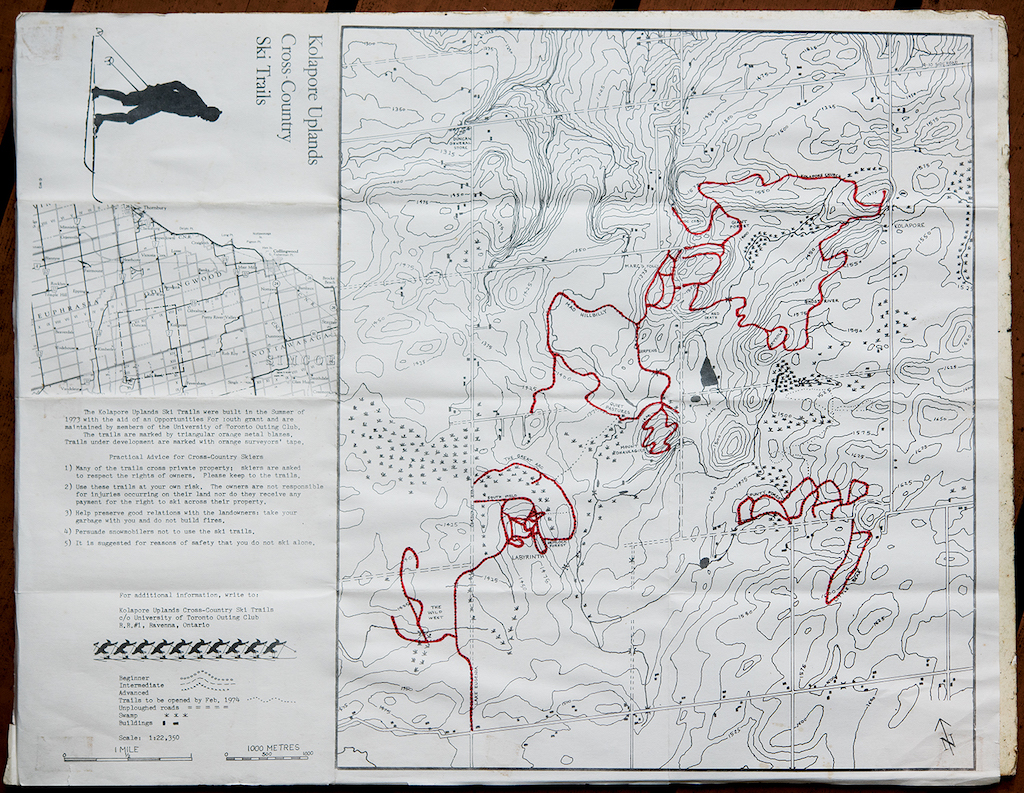
In 1974 the first trail map was created. In Bruce’s words, “It was a crude, hand drawn, hand coloured map.” Throughout the latter half of the 70s the committee relied on volunteers to help create the network of cross country trails. The group was no longer receiving any money from the U of T Outing Club, and were entirely self-sufficient. They raised funds mainly through donations and map sales, with the first “sophisticated” full colour map appearing in 1977. Since the work was volunteer based, construction switched from the summer months to weekends during the fall. Students would go to school mid-week and head up to the Outing Club Cabin on weekends to do trail work. “We had a great time with our friends working on the trails. We looked forward to the weekends. Plus, you knew if you improved something you would get the benefit later on,” remembers Bruce. “I still have a number of friends from that era. Some still work on the trails, and a few have bought places up here”.
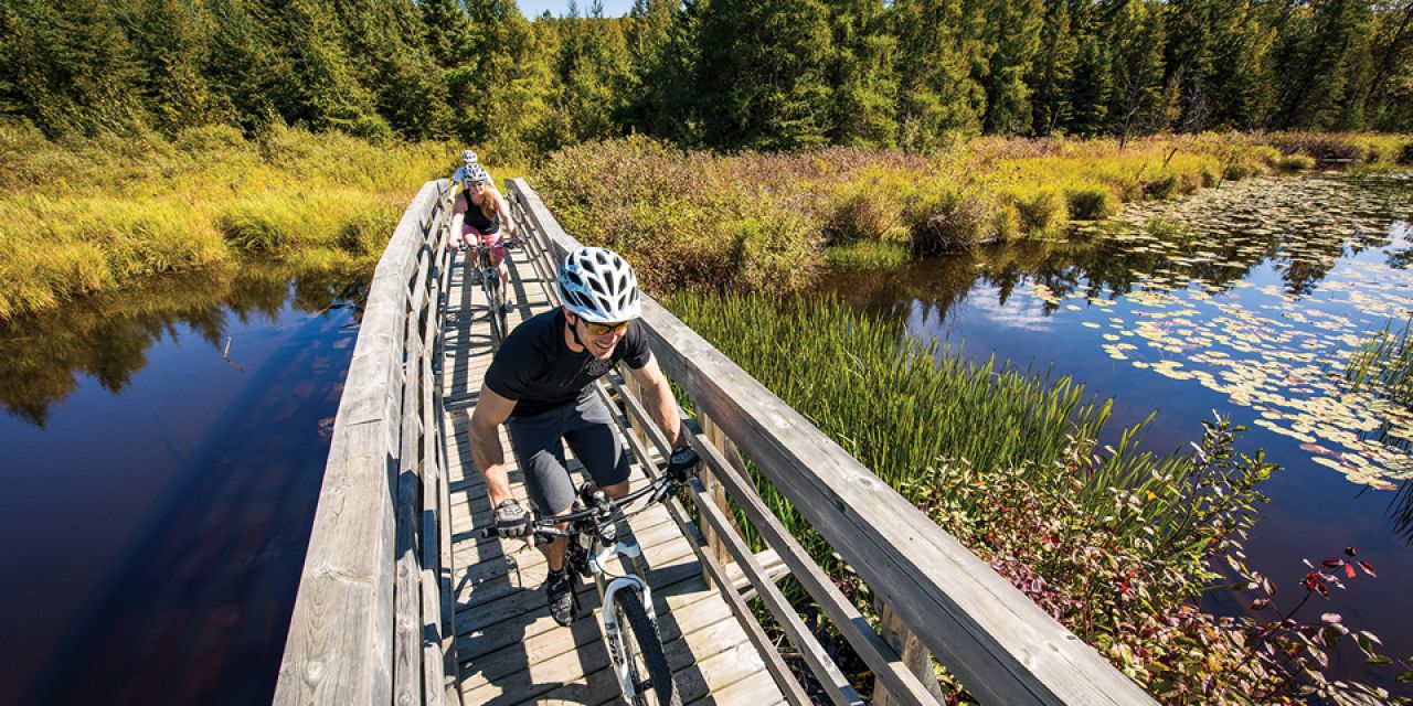
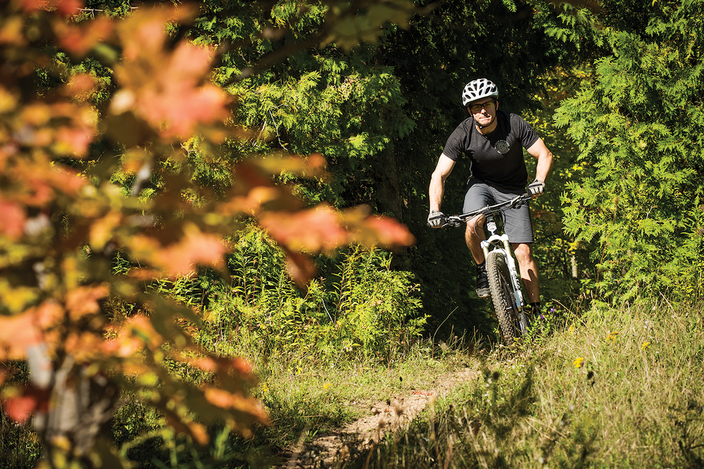
 By the 80s trail signs started going up, with some of the original signs still there today. It was also around this time that mountain biking started to gain popularity. It wasn’t long until riders discovered the Kolapore network. The long flowing trails lent themselves perfectly to this new found recreational activity. But with biking came an entirely new set of requirements for trail building. Erosion and trail flow became an important part in the planning process. Previously trails were designed strictly for cross country skiing. Rough or rocky trails weren’t much of a concern since everything would be covered in a few feet of snow.
As summer usage increased for both hiking and biking there was a push for more grass roots involvement. Volunteers were needed more than ever to maintain the existing net- work, and to help create new trails that were both skiing and biking friendly. The volunteer group was still technically a subcommittee of the U of T Outing Club, but had little or no involvement with the university. Recognizing a need for a legal structure that was separate from the University of Toronto, the group of dedicated volunteers created the Kolapore Trails Association in 2011.
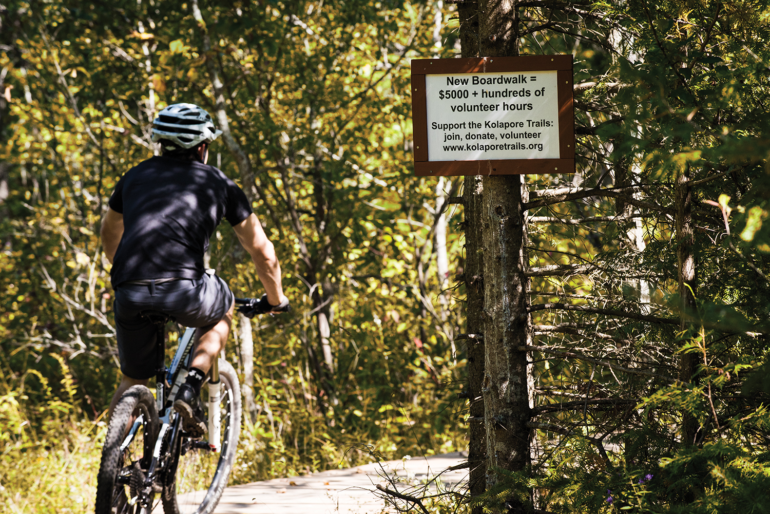
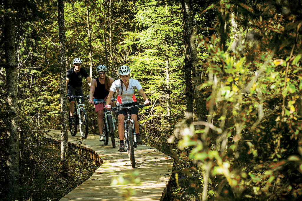
Today the Kolapore Trails Association still raises money through donations and map sales—money that is put into building projects like the recently completed boardwalk on “Paradise Highway”—that project cost over $5,000 in building materials alone. The association also covers the costs of snow plowing for the parking lot on Grey Road 2, and the portable toilet that is there for trail users.
 It is a common misconception that the University of Toronto owns the Kolapore trails. Most of the network is situated in a Grey County Managed Forest. It is public land, but not a designated park. There are also a few privately owned swaths of forest throughout the area, and the Kolapore Trails Association is quick to point out their appreciation for the continued use of private land.
Grey County has come on board to help develop and improve the network plans are underway to improve existing routes and develop new sections in the South East portion, also known as the “County Trails”.
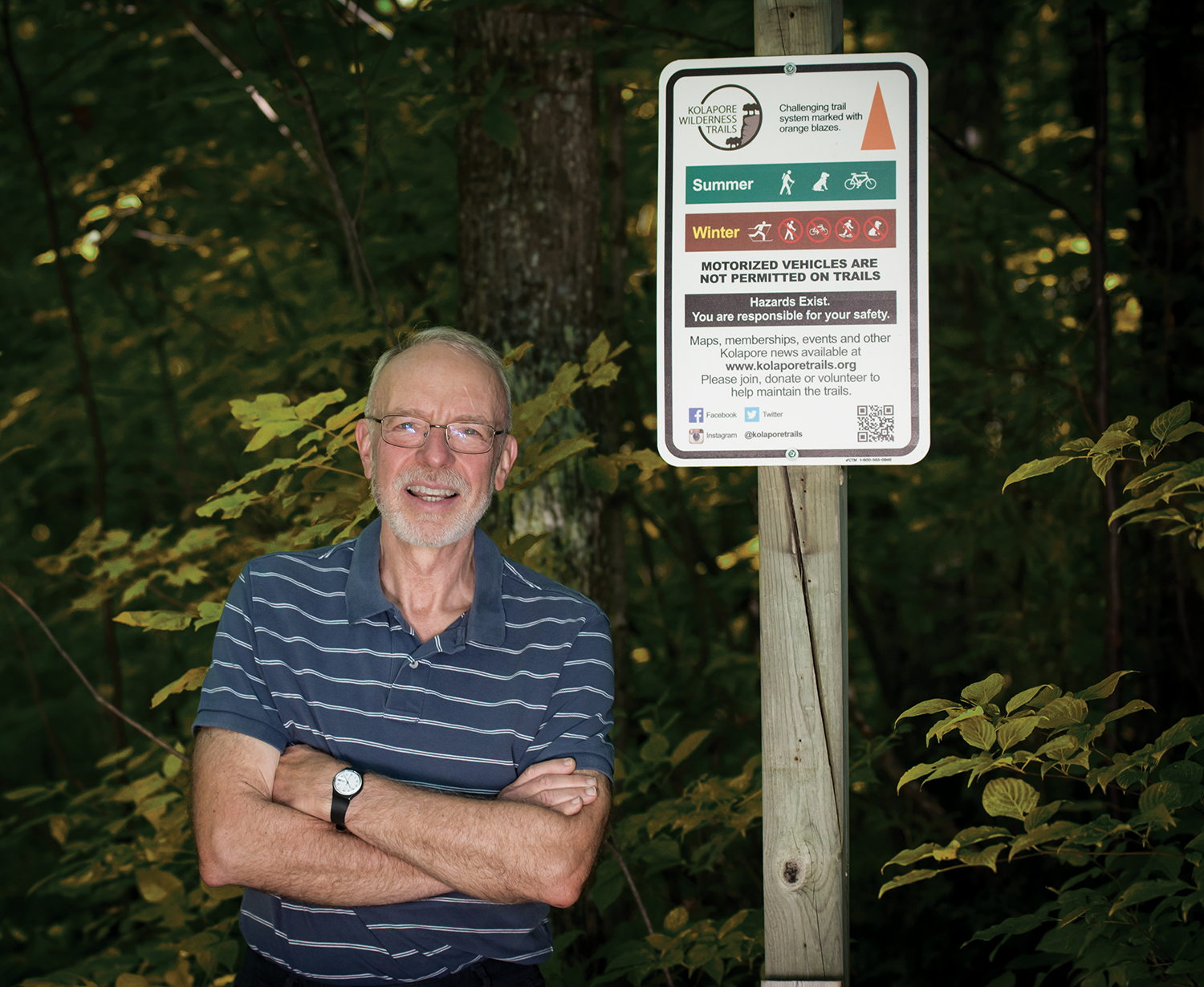
The goal is to make more family friendly and beginner oriented trails. Brock Martin who has taken up the role as lead of trail maintenance and is responsible for many of the recent improvements will be one of the volunteers helping with the new improvements. It is Brock’s hope that these improvements will help in- crease the enjoyment for all users.
As plans are underway to increase the number of trails, the need for volunteers is a great as ever and in recent years, a younger generation of volunteers have come on board. Kevin Walsh joined the board of directors just last year and is heading up communications, web and social media. Kevin was attracted to the organization, not just because he enjoys using the trails, but as he says, “The association is being led by people in the community, and it is users who are building trails for users. It’s really impressive what people have put together over the years.” It is Kevin’s hope to attract more summer users—especially bikers—to this impressive and important organization. To find out more go to: kolaporetrails.org |E|


