92
Escarpment Magazine Winter 2014
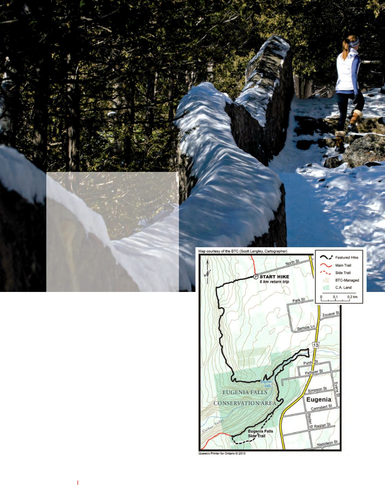
After a good hike, you will be standing at the
top of Eugenia falls where the Beaver River tum-
bles over the edge of the Escarpment. Here you
will also encounter a stone arch, the mark of the
end of an old tunnel once dug in an attempt to
harness the energy generated by the river. The
water flow is now controlled by a hydro-electric
dam further upstream, creating a tall narrow wa-
terfall. From here, hikers will follow along the
west side of the river then cross over at a pedes-
trian bridge in the town of Eugenia. Don't miss
the quick turn back into the forest once you have
crossed over the bridge.
On the east side of the river there is a stone wall
that hugs the edge of the gorge. Grab your cam-
era, there are many breathtaking view points of
the falls along this wall. From here, you can head
down the 400 metre side trail loop and for the
more adventurous you can make your way down
into the gorge and find yourself at the base of
the waterfall. This trail is known to be quite
treacherous; so if you have little ones with you,
stay on the main trail.
There are a few different ways to reach the falls;
we chose to feature the longer version for its
physical challenges. To get to the start of this
hike, head south of Kimberly on Grey Road 13
toward the town of Eugenia. Turn west onto
North Street; this road will come to a dead end
where you'll find parking and the Bruce Trail
sign. Be sure to follow the white blazes, wear
layers; bring water and your camera.
|E|
GPS Cordinates: 44.32001,—80.527883
ESCARPMENT
®
HIKE
|
sectioning the bruce


